
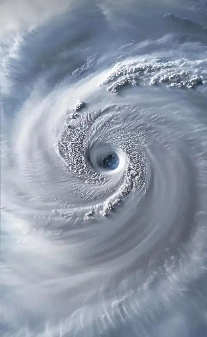
Hurricane Polo underwent one of the most dramatic intensifications of the 2026 Pacific hurricane season, exploding from a tropical storm into a Category 5 hurricane in less than a day. Satellite imagery from NOAA’s GOES-18 captured the storm in striking detail as it spun off the southwestern coast of Mexico, with repeated lightning flashes illuminating its powerful eyewall and giving the cyclone an almost living appearance from space.
Rapid Intensification in the Eastern Pacific
Just two days before reaching peak strength, Polo was a tropical storm with maximum sustained winds of about 75 km/h. Within a remarkably short period it strengthened into a major hurricane and then attained Category 5 status on the Saffir-Simpson scale. Reports from aircraft reconnaissance and satellite estimates placed sustained winds in the range of 260–285 km/h at peak, accompanied by an exceptionally low central pressure. The rate of strengthening far exceeded the threshold for rapid intensification and ranked among the more extreme examples recorded in the eastern Pacific basin.
The storm drew energy from unusually warm ocean waters and a favourable atmospheric environment characterised by low wind shear and abundant moisture. These conditions allowed the cyclone’s circulation to organise quickly and its central pressure to fall sharply.
What the Satellites Revealed
Imagery from the GOES-18 satellite provided a vivid view of Polo’s structure. The Advanced Baseline Imager showed tightly coiled bands of thunderstorms spiralling around a well-defined eye, while the Geostationary Lightning Mapper detected frequent and intense lightning activity concentrated in the eyewall—the ring of towering storms that surrounds the calm centre.
In time-lapse sequences covering roughly two hours, bright flashes repeatedly lit up the eyewall, creating the impression of a pulsing, almost animate system. Such concentrated lightning is often associated with vigorous updrafts and intense convective bursts, signatures of a healthy and powerful hurricane. High-resolution views from polar-orbiting satellites further confirmed the storm’s compact and symmetric appearance at peak intensity.
Location and Expected Track
At the time the dramatic imagery was captured, Polo was located a few hundred kilometres off the southwestern coast of Mexico, in the vicinity of the Guerrero and Michoacán coastlines. Forecasts indicated that the storm would remain largely offshore, drifting slowly before turning northwestward and moving parallel to the Mexican coast. While the core was not expected to make a direct landfall, the proximity of such an intense system still carried significant risks for coastal areas.
Threats to Land Areas
Even without a direct hit, Category 5 hurricanes can generate dangerous effects far from their centres. Officials warned of heavy rainfall capable of producing life-threatening flash floods and mudslides, particularly in regions of steep terrain along Mexico’s Pacific coast. Large swells and hazardous surf conditions were also anticipated, posing dangers to mariners and beachgoers. Tropical-storm-force winds were expected to affect portions of the coastline even if the strongest winds stayed over water.
Mexican authorities monitored the system closely and advised residents in potentially affected states to remain vigilant. The combination of intense rainfall and the possibility of prolonged impacts from a slow-moving storm elevated the concern for flooding.
Scientific Significance
Polo’s rapid rise to Category 5 intensity added to a season already notable for powerful eastern Pacific systems. Meteorologists pointed to the role of warm sea-surface temperatures in fuelling the explosive deepening. The storm’s evolution also offered a clear illustration of how quickly tropical cyclones can change character when environmental conditions align, underscoring the importance of continuous satellite and aircraft monitoring.
The GOES-18 imagery itself served both operational and public-communication purposes. Beyond aiding forecasters in tracking structural changes such as eyewall replacement cycles, the visually compelling sequences helped convey the storm’s intensity to a wider audience.
Broader Context of the 2026 Season
The appearance of multiple high-end hurricanes in the eastern Pacific during 2026 reflected the influence of large-scale climate patterns that favoured above-average ocean heat content in the region. Systems like Polo demonstrated both the destructive potential of these storms and the advances in observational technology that now allow scientists and the public to witness their structure in near real time.
As Polo continued its path over open water, attention remained focused on whether it would maintain Category 5 strength, how its structure would evolve through any eyewall replacement cycles, and the precise distribution of rainfall and wave impacts along the Mexican coast. The satellite record of its peak intensity—lightning flashing around a sharply defined eye—will stand as one of the most memorable visual documents of the season.
Hurricane Polo’s transformation from a modest tropical storm into a formidable Category 5 cyclone, captured so vividly from space, serves as a powerful reminder of the energy contained in the tropical oceans and the vigilance required when such systems approach land.
Read more – slangpilot.com